Beschrijving
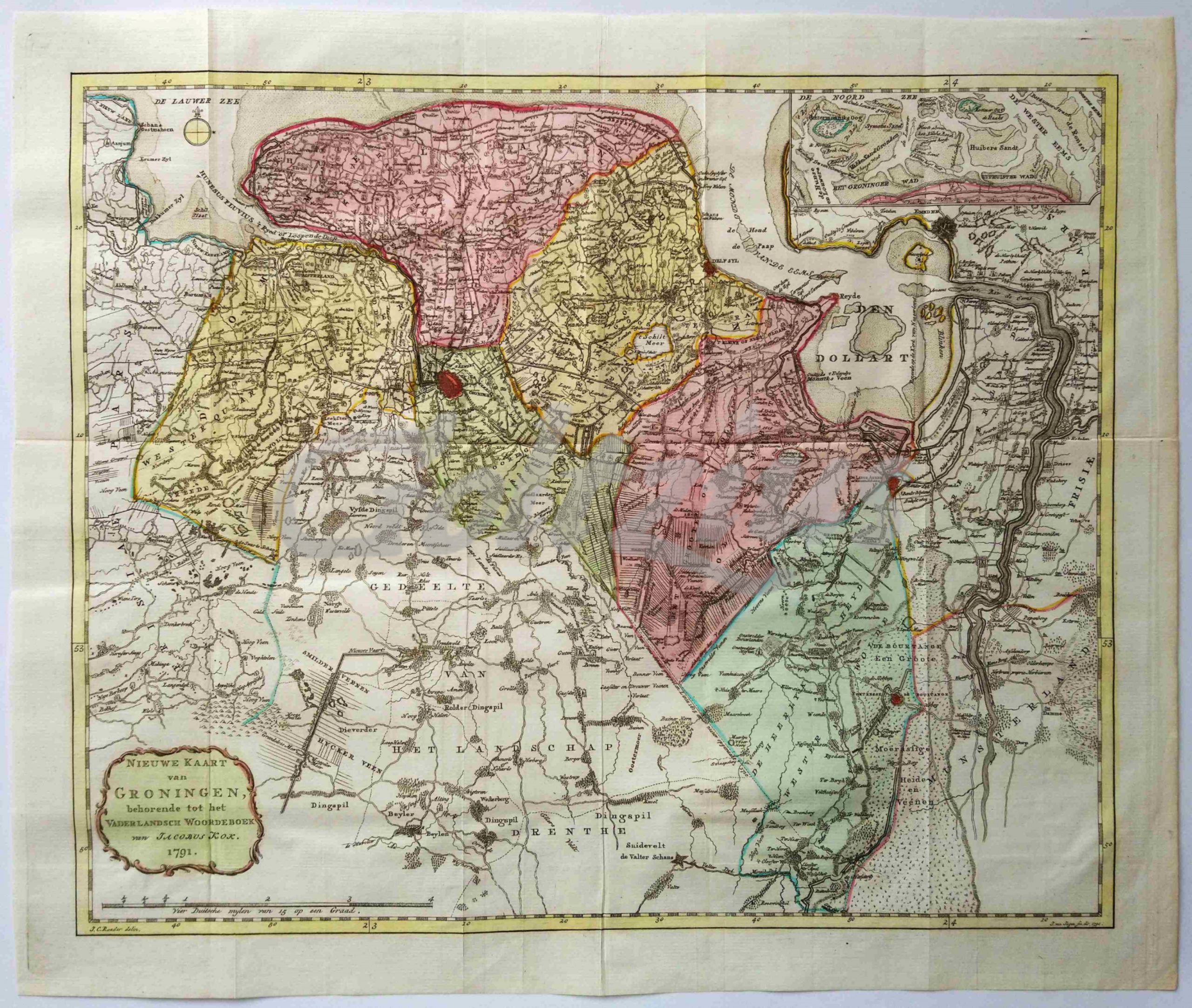
Map of the Dutch province of Groningen.
Engraving on hand laid paper, with hand colouring. Sheet size 435 x 364 mm., platemark 420 x 350 mm. Made by Jan van Jagen (1707-1800) after J.C. Roeder, and published in Jacobus Kok, 'Vaderlandsch Woordenboek', Amsterdam: Johannes Allart, 1780-1796. This map dated 1791.
In very good condition, with folds, as issued, margin edges minimally discoloured.