Beschrijving
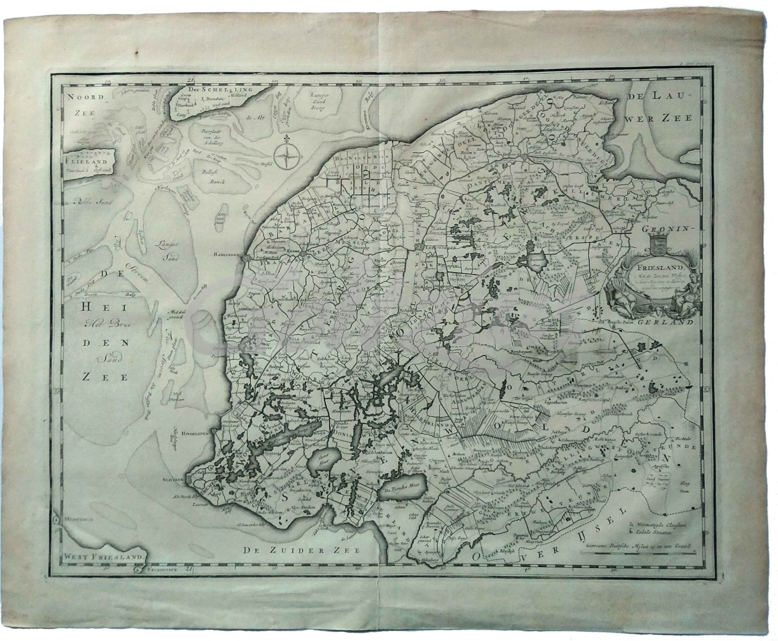
Detailed antique map of the Dutch province Friesland, with a cartouche in the right edge. The area covered spans from Vlieland and Terschelling (top left) to the Lauwersmeer (here Lauwer Zee, top right) and Medemblik and Enkhuizen lower left.
Engraving on hand laid paper, sheet size 498 x 402 mm., platemark 441 x 336 mm. Made by Frederik Ottens (active ca. 1717-1770), and published by Hendrik Halma, in 1725 in: 'Tooneel der Vereenigde Nederlanden, en onderhorige landschappen […]', Leeuwarden: Halma, 1725.
Middle fold, as issued. Margin edges faintly browned, and with some small damages (backed with archival tape). A longer tear in the middle fold, from the lower edge a little into the image (closed with archival tape).